Decksteiner Weiher
Artificial rowing lake in Cologne's Outer Green Belt — 5.8 km loop trail, boat hire, and a goshawk breeding site on its island since 1987.
since 1929
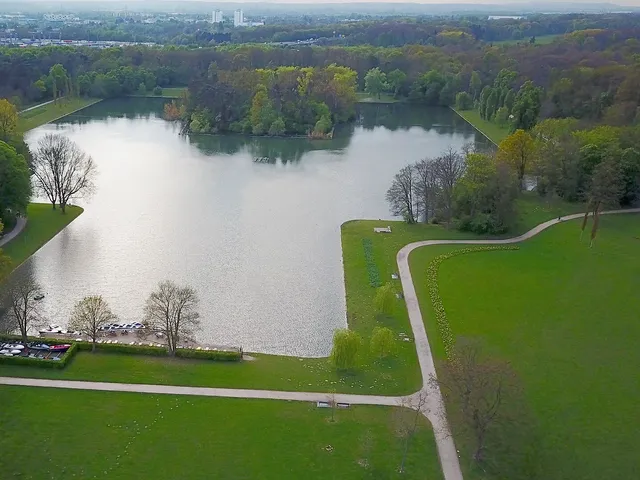
The Decksteiner Weiher is an artificially created lake with straight-cut banks, set within Cologne's Outer Green Belt. It defines this section of parkland so completely that no other name has ever taken hold.
At a Glance
- Type
- Artificial lake with straight-cut banks
- Location
- Outer Green Belt, Sülz district, Lindenthal borough
- Created
- 1927–1929
- Size
- approx. 20 hectares, around 1.5 m deep
- Loop trail
- shortest route around the lake approx. 5.8 km
- Notable feature
- goshawk breeding site on the island since 1987
- Swimming
- not designated as a bathing lake; swimming is prohibited
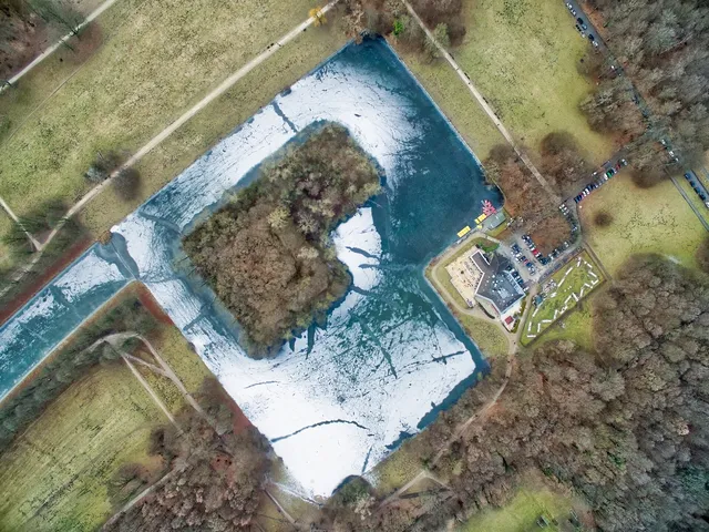
Since 1987, goshawks have nested on the undisturbed island in the lake – this was the very first breeding pair in the entire city of Cologne, a population that has since grown to around 20 pairs.
Things to do here
- Stroll the roughly 5.8 km loop trail around the pond
- Rent a pedal boat at the "Haus am See" and glide across the water
- Stop in on the lakeside terrace of the "Haus am See" and enjoy the view over the water
- Go for a jog along the shady paths of the green belt
- Watch the waterfowl and the hawks nesting on the island
- Relax on a bench by the shore and watch the rowing boats pass by
Water area comparison
Water area compared with other lakes in Cologne.
Age comparison
Age compared with other places in Cologne.
History
The lake was created between 1927 and 1929 under city building councillor Theodor Nußbaum, head of the Cologne Parks Department's design office. It formed part of the conversion of the former ring of fortifications into the Outer Green Belt, following the master plan of Fritz Schumacher and ideas put forward by Konrad Adenauer; the work was carried out as part of a job-creation scheme. Nußbaum was an enthusiast for water sports and laid out the lake as a training course for rowing. The name derives from the settlement of Deckstein, a former farmstead with a mill near the hamlets of Kriel and Lind.
Design
A square section with an inaccessible central island is connected by a canal flanked by a chestnut avenue to a larger basin to the south-east. A square area with a widened plane-tree avenue and a broad boat jetty juts into the south-eastern end. In the north-western corner, a recess accommodates the "Haus am See" restaurant with its outdoor terrace. Spoil from the excavation was piled up along the southern side to form hills that serve as toboggan runs in winter.
Nature and Fish
The lake has no natural inlet or outlet; groundwater is pumped in as needed. The muddy bed is home to carp, perch, bream, pike, tench, zander and eel, with angling managed by the Cölner Angel- und Gewässerschutzverein. The goshawks nesting on the undisturbed island were Cologne's first breeding pair; the city now hosts around 20 pairs.
Recreation and Surroundings
The "Haus am See" offers boat hire including pedal boats, and a mini-golf course is nearby. At the opposite end, the sports complex of 1. FC Köln adjoins the lake. Two rings of footpaths with park benches encircle the water, with bridle paths running slightly further out. Tree plantings buffer the noise from the nearby A4 motorway and Militärring road. A running club offers various loop routes, and a fitness trail along Berrenrather Straße was added in 2013. The area is also reachable via a footbridge from Beethovenpark and from Hürth on the far side of the Green Belt.
Timeline
- 1919–1927Expansion of the city forest with the Adenauerweiher (precursor project)
- 1927–1929Construction of Decksteiner Weiher by city building director Theodor Nußbaum
- 1929Completion and opening of the pond
- 1987First breeding pair of goshawks in Cologne nests on the pond island
- 2013Fitness trail installed at the lake's southern end (Berrenrather Straße)
Map
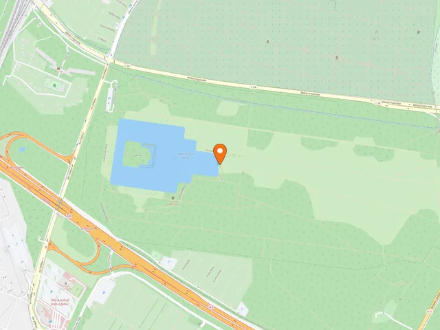
Blue dots: other places nearby — tap to explore.
Address
Decksteiner Weiher
Köln
You might also like — related or nearby
Comments
- Loading comments…
Sources & links
Auto-generated, last verified: 2026-06-26
How this page is made
This page draws on open sources — Wikipedia, Wikidata, official websites and the city’s open data. Every statement is checked against the sources linked here, and pages are refreshed regularly.
Spotted a mistake anyway? Tell us below — we read every submission.