Beethovenpark
Natural landscape park in Sülz with a wide open meadow, playgrounds and a barbecue area — laid out in the 1920s as part of Cologne's Outer Green Belt.
Beethovenpark stretches across the southwest of Cologne — a largely natural landscape park with adjoining formal gardens, named after Ludwig van Beethoven and created in the 1920s as part of the city's Outer Green Belt.
At a Glance
- Type
- Landscape park with formal gardens
- Location
- Sülz district, Lindenthal borough
- Size
- 40.4 hectares
- Created
- 1925–1927 as Volkspark Sülz
- For families
- Playgrounds and barbecue area
- In winter
- Sledding slope on the Trümmerberg
- Viewpoints
- "Sülzer Balkon" and the "Pilz" platform
The hilly 'Trümmerberg' in Beethovenpark was created in 1953 from wartime rubble – it is one of eleven such debris mounds in Cologne and today serves as a popular sledding hill in winter.
Things to do here
- Stroll across the wide meadow and enjoy the nature
- Spread out a picnic on the lawn
- Let the kids romp on the playgrounds
- Take in the view from the "Sülzer Balkon" and the "Pilz" platform
- Have a barbecue at the grilling area
- Go sledding down the rubble-hill slope in winter
Area comparison
Area compared with other Cologne parks and green spaces.
Origins
Mayor Konrad Adenauer sought to transform the outer fortification belt into a woodland and meadow ring along the lines of the garden city movement; urban planner Fritz Schumacher added the concept of radial green corridors to bring greenery into the heart of the city. On the site of the former Esser gravel pit, parks director Fritz Encke designed a two-part public park in 1924. Construction began in 1925 and was completed by 1927 by Encke's successor Theodor Nußbaum following revised plans.
Formal Gardens
The strictly structured formal gardens line Neuenhöfer Allee. A tall ring of poplars — a motif Encke used frequently in the 1920s — rises at their centre, flanked by playgrounds shaded by mature trees. A former rose garden was abandoned in the 1990s due to maintenance costs, and a second formal garden once occupied the site now used by the KHCT Blau-Weiß tennis courts.
The Open Meadow
At the heart of the landscaped section lies the sunken, expansive Volkswiese (public meadow), shaped from the former gravel pit. Winding paths traverse it, and circular groups of trees rise like small islands across the grass, echoing the poplar-ring motif on a smaller scale. To the south, a large ring of conifers forms a counterpoint.
Location and Surroundings
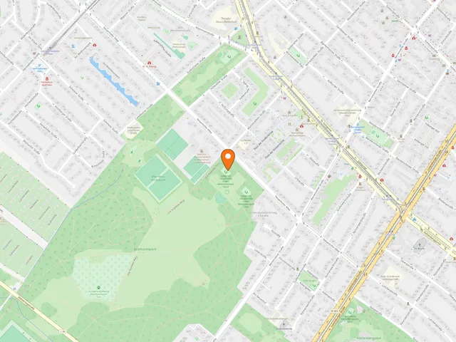
The park is bounded by Neuenhöfer Allee to the north, Berrenrather Straße to the east, and Castellauner Straße and the Sülz allotments to the west. South of the Militärring it merges into the Outer Green Belt; to the east, a green corridor links it to Klettenbergpark. The semicircular "Sülzer Balkon" viewpoint looks out over the park, while the tower of the Sülz orphanage church is visible in the opposite direction.
Trümmerberg and the View
In 1953 the eastern part of the park was reshaped by the construction of a long rubble mound from wartime debris. This Pilzberg — one of eleven such rubble hills in Cologne — bears a covered viewing platform called "Pilz" (Mushroom) at its highest point, with open views to the north and west. In winter the slope becomes a popular sledding hill.
Timeline
- 1924Garden director Fritz Encke plans a two-part public park
- 1925Construction of Volkspark Sülz begins
- 1927Completion of the park by Encke's successor Theodor Nußbaum
- 1953Rubble hill constructed in the east, altering the park layout
- 1990erRose garden removed for financial and maintenance reasons
Map
Blue dots: other places nearby — tap to explore.
Address
Berrenrather Str.
50937 Köln
Hours
So: 00:00–24:00
You might also like — related or nearby
Comments
- Loading comments…
Sources & links
Auto-generated, last verified: 2026-06-26
How this page is made
This page draws on open sources — Wikipedia, Wikidata, official websites and the city’s open data. Every statement is checked against the sources linked here, and pages are refreshed regularly.
Spotted a mistake anyway? Tell us below — we read every submission.