Westhovener Aue
A roughly 0.7 km² recreation and nature area on the right bank of the Rhine in Westhoven – a restored former military site and flood-retention space.
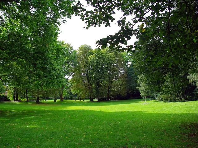
The Westhovener Aue, rarely also called Westhovener Wigge, is a recreation area and former military site on the Rhine in the Westhoven district.
At a Glance
- Type
- Rhine floodplain, recreation and nature area
- Location
- right bank of the Rhine, Westhoven district (Porz borough)
- Size
- about 0.7 square kilometres
- Background
- former military site, restored from 2004/05
- Function
- flood-retention space (flooded above a Cologne gauge of 9 m)
- Note
- access only on the surfaced paths
Because unexploded ordnance from the Second World War is still suspected on the former military site, entering the Westhovener Aue off the surfaced paths is prohibited – as recently as 2017 a 125-kilogram bomb was found and defused there.
Things to do here
- Walk the Westhoven towpath along the Rhine
- Watch waterfowl and the floodplain landscape
- Explore the restored Rhine floodplain – on the surfaced paths only
Area comparison
Area compared with other Cologne parks and green spaces.
Nature
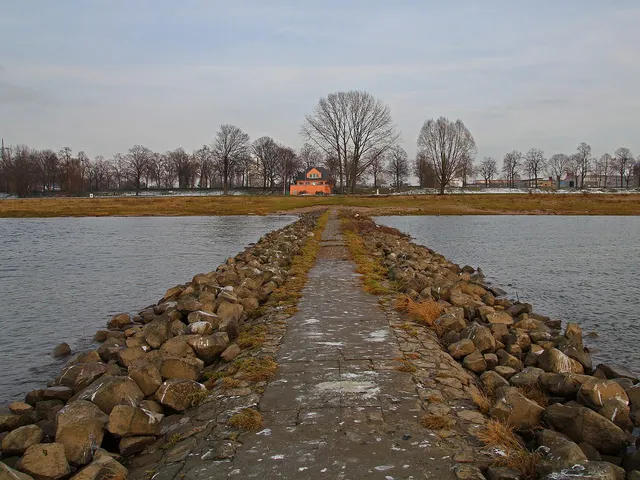
In the 2004/05 restoration the choice of plants followed the natural floodplain vegetation; the remaining areas are left to free succession. The meadow is home to waterfowl such as mallard, coot, Egyptian goose, Canada goose and – rarely – the mute swan; the red fox roams the grasslands. In the lake the carp is most common, followed by pikeperch and bream.
From Military Site to Recreation Area
In the western part of the meadow the intermediate fort IXa was built between 1876 and 1881, the southernmost right-bank work of Cologne's fortress ring. From 1935 an engineer barracks was erected between Kölner Straße and the Rhine, with the meadow serving as a land training ground. After the Second World War Belgian forces used the barracks before leaving the site in 1995. In 1985 the towpath along the Rhine was reopened; from 2004 the city of Cologne dismantled the training ground.
Today
In the late 1980s the city decided against development and in favour of keeping the meadow as a retention area; above a Cologne gauge of nine metres it floods. The site has been open to the public since spring 2005. Because of possible unexploded ordnance, however, entering off the surfaced paths is forbidden.
Timeline
- 1876Construction of the intermediate fort IXa as part of Cologne's fortress ring (until 1881)
- 1935Start of construction of an engineer barracks between Kölner Straße and the Rhine
- 1985The Westhoven towpath along the Rhine is reopened to the public
- 2004Restoration and dismantling of the former training ground begins
- 2005The site is opened to the public
Map
Blue dots: other places nearby — tap to explore.
Address
In d. Westhovener Aue
Köln
Hours
So: 00:00–24:00
You might also like — related or nearby

Comments
- Loading comments…
Sources & links
Auto-generated, last verified: 2026-07-01
How this page is made
This page draws on open sources — Wikipedia, Wikidata, official websites and the city’s open data. Every statement is checked against the sources linked here, and pages are refreshed regularly.
Spotted a mistake anyway? Tell us below — we read every submission.