Rheinaue Langel-Merkenich
A nature reserve on the Rhine's left bank in northern Cologne, with floodplain forest, hay meadows and a near-natural riverbank between Langel and Merkenich.
since 1989
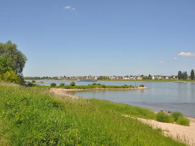
The Rheinaue Langel-Merkenich nature reserve runs along the left bank of the Rhine in the north of Cologne. Across a good 247 hectares, floodplain forest, meadows and riverbank zones alternate to form a near-natural stretch of river landscape.
Source: Wikipedia
At a Glance
- Location
- On the Rhine between Langel to the north and Merkenich to the south-west, City of Cologne (North Rhine-Westphalia)
- Protection status
- Designated nature reserve, reference K-007
- Area
- 247.54 hectares
- Landscape
- Rhine floodplain with willow floodplain forest, lush hay meadows and field copses
- Neighbourhood
- Borders the 205-hectare Rheinaue Worringen-Langel nature reserve to the north-west
- Roads
- The A1 motorway cuts through the area, with the K11 district road running along its western edge
Area comparison
Area compared with other Cologne parks and green spaces.
Age comparison
Age compared with other places in Cologne.
Location & Surroundings
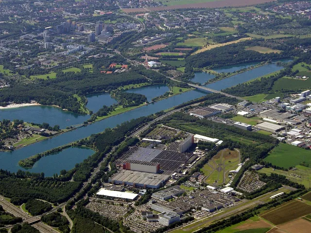
The reserve stretches along the Rhine through Cologne's northern districts, from Langel in the north down to Merkenich in the south-west. The A1 motorway runs straight through the middle, while the K11 district road skirts its western side. To the north-west, the Rheinaue Worringen-Langel reserve (205 hectares) adjoins it directly, so that together the two form an extensive protected floodplain corridor.
Protection Status
Listed under the reference K-007, the Rheinaue Langel-Merkenich is a designated nature reserve. At 247.54 hectares, it ranks among the larger protected areas within Cologne's city limits.
Vegetation & Landscape
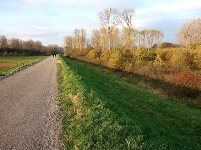
The bank presents itself as a partly gravelly, partly sandy tideline that gives way, further inland, to clusters of trees and shrubs and a nutrient-rich fringe of tall perennials. Willow floodplain forest dominates in the north, while the centre opens out into a species-poor but leaf-rich hay meadow, broken up here and there by isolated field copses — mostly planted stands of poplar filled out by self-seeded growth. These copses grow denser in the southern section than in the north.
Further south lie smaller woodlands, some with the character of a hardwood floodplain forest and dominated by maple; at the very southern end, non-native plants take hold as well. Inland, arable fields, lush pastures, kitchen gardens and an old, grazed traditional orchard round out this varied patchwork of a landscape.
Gallery
Map
Blue dots: other places nearby — tap to explore.
You might also like — related or nearby
Comments
- Loading comments…
Sources & links
Auto-generated, last verified: 2026-08-09
How this page is made
This page draws on open sources — Wikipedia, Wikidata, official websites and the city’s open data. Every statement is checked against the sources linked here, and pages are refreshed regularly.
Spotted a mistake anyway? Tell us below — we read every submission.