Kölner Stadtwald
Expansive forest park in the Lindenthal district, laid out from 1895 to plans by Adolf Kowallek — with ponds, a wildlife enclosure and petting zoo.
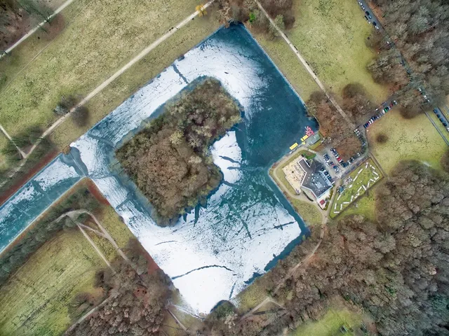
The Kölner Stadtwald is a park created in the late 19th century in the Lindenthal district, serving as a recreational green space on the left bank of the Rhine. The grounds feature ponds, water channels, a wildlife enclosure, and sports and play areas, connected by an extensive network of paths.
At a Glance
- Type
- urban forest park
- Location
- Lindenthal district, along Dürener Straße
- Founded
- resolution passed on 4 July 1895
- Designer
- Garden Director Adolf Kowallek
- Pond
- approx. 3.9 ha, fed by the Frechener Bach, with two islands
- Animals
- wildlife enclosure with petting zoo
- Facilities
- walking paths, meadows, sports and play areas
When the Stadtwald pond was excavated in 1896, a staggering 54,000 cubic metres of earth were removed – transported away by a narrow-gauge field railway laid specially for the construction project.
Things to do here
- Stroll along winding paths through the sprawling woodland park
- Wander along the large pond and cross the bridge to the island
- Discover the wildlife enclosure and get close to the animals in the petting zoo
- Picnic on the open meadows and let the kids romp on the playground
- Go for a jog or use the sports grounds for some exercise
- Capture the water channels and ponds as photo spots in the historic park landscape
Area comparison
Area compared with other Cologne parks and green spaces.
Location and Surroundings
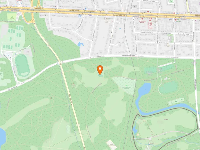
The core area is bordered by Fürst-Pückler-Straße, Friedrich-Schmidt-Straße, Militärringstraße and Dürener Straße. The green spaces extend towards the Braunsfeld and Müngersdorf districts. The section beyond the Militärring between Dürener Straße and Aachener Straße is known as the Stadtwald extension.
Origins: Hofgut Kitschburg
The western outskirts of the city were once home to the Kitschburg, first recorded in tax registers in 1669. In 1715 the estate passed to Cologne's seminary; during the French period it came into state ownership and later served as a summer residence for the banker Abraham Schaaffhausen. After Lindenthal was incorporated into Cologne in 1888, the city acquired the land. The oldest surviving structure is an outbuilding of the farmstead at Dürener Straße 285, whose roof timbers bear the date 1759.
Planning and Layout
In 1895 the city acquired the woodland, farmland and meadows between Dürener Straße and Aachener Straße. Adolf Kowallek — who had previously overseen the creation of the Volksgarten in the Südstadt — designed a historicist-inspired parkland, incorporating existing older plantings and tree stands around the Kitschburg.
The Stadtwaldweiher
From March 1896, a pond of approximately 3.9 hectares was created alongside the old Kitschburg, fed by the Frechener Bach. It has two islands, one accessible via a bridge. Around 54,000 cubic metres of excavated material were carried away using a light field railway.
Timeline
- 1669Kitschburg first recorded in tax registers
- 1715Kitschburg (30 acres) transferred to Cologne Seminary
- 1831Tax survey: eleven residents and two households on the estate
- 1888Lindenthal incorporated; City of Cologne acquires the grounds
- 1895City council resolves on 4 July to construct the Stadtwald
- 1895Kowallek designs the park in Historicist style
- März 1896Construction of the approx. 3.9 ha Stadtwald pond begins
- Mai 1902Death of Adolf Kowallek; Robert Jung takes over as acting director
Map
Blue dots: other places nearby — tap to explore.
Address
Dürener Str.
50935 Köln
Hours
So: 00:00–24:00
You might also like — related or nearby
Comments
- Loading comments…
Sources & links
Auto-generated, last verified: 2026-06-26
How this page is made
This page draws on open sources — Wikipedia, Wikidata, official websites and the city’s open data. Every statement is checked against the sources linked here, and pages are refreshed regularly.
Spotted a mistake anyway? Tell us below — we read every submission.