Kölner Randkanal
A nearly 20 km drainage canal on Cologne's city boundary — keeps the open-cast lignite mines dry and doubles as a continuous cycling route with a hydropower screw.
The Kölner Randkanal is a nearly 20-kilometre drainage canal running along the northern and western outskirts of Cologne. Its primary purpose is to keep the Rhenish lignite open-cast mines near Frechen dry, while also serving as a recreational corridor through the left-bank countryside.
Source: Wikipedia
At a Glance
- Type
- Drainage canal, operated by a joint authority of industry and local municipalities
- Length
- 19.68 km from the Ville tunnel, including 2.24 km underground (Worringen tunnel)
- Route
- From Frechen-Königsdorf to a piped outfall into the Rhine at Cologne-Worringen (Rhine km 710.5)
- Built
- 1954–1959
- Suitable for
- Cycling along the entire route
At the canal's crossing with Hugo-Junkers-Straße in Pulheim, a water power plant has been operating since 2011 using an inverted Archimedes' screw – a principle originally invented to lift water, here turned around to generate 200,000 kWh of electricity per year, making it the only hydroelectric installation in the entire area of the participating districts and municipalities.
Things to do here
- Cycle the continuous bike path from Frechen-Königsdorf to Cologne-Worringen
- Take a break on the brick sofa seating group in the estuary park
- Follow the 'Energy & Water' themed trail with its 22 storytelling stations
- Watch the water-power screw turbine at work in the Pulheim industrial area
- Explore the countryside west of the Rhine along the canal
- Pause at the 'dining room' rest stop and enjoy the surroundings
Purpose and Function
The canal's main job is to drain the open-cast lignite mines near Frechen. It also handles surface water drainage for the Rhein-Erft district and carries treated wastewater from several sewage works, including effluent from the Cologne districts of Esch, Auweiler, Pesch, and Widdersdorf. Following a major refurbishment between 2010 and 2015, it once again contributes to flood protection along the River Erft: a weir near Horrem-Götzenkirchen allows excess water to be diverted into the canal and onward to the Rhine.
Südkanal (South Canal)
The southern branch was built in 1956 and 1959 between Lövenich and Hermülheim, running partly underground through Cologne's territory. At Lövenich it joins the main canal coming from Frechen. The southernmost stretch between the old and new Hürth sewage treatment plants is usually dry, only carrying stormwater during heavy rainfall. A separate authority is responsible for its maintenance.
Construction and Safety
Where the canal runs above ground it is built with concrete walls and steep banks, flanked on both sides by dense hedgerows. The strong current has meant that people and animals involved in accidents have repeatedly been unable to get out of the water. For this reason, rescue ladders fitted with floats are installed beneath the bridges.
Recreation
The steep, largely straight concrete channel is a difficult fit ecologically. As part of the RegioGrün project under the Regionale 2010 initiative, the banks were greened up, rest areas were created, and paths were improved. A signposted cycle route has run from Frechen-Königsdorf to Cologne-Worringen since 2012. At the outfall into the Alter Worringer Hafen, a small waterfront park was created, featuring a brick 'living room' shaped like a sofa and armchairs; a steel-framed 'dining room' rest stop and a themed trail called 'Energy & Water' — with 22 information stations and three anchor points — followed in 2013.
Hydropower Installation
At the intersection with Hugo-Junkers-Straße in the Pulheim industrial estate, a hydropower plant has been running since May 2011. Using an Archimedes screw in reverse, it processes water impounded in a retention basin and feeds around 200,000 kWh per year into the Rheinenergie grid — the only hydropower facility in the surrounding districts and municipalities.
Timeline
- 1954–1959Construction of the Cologne Randkanal (approx. 20 km)
- 1956Construction of the southern Randkanal (Südkanal) begins
- 1959Südkanal completed to Hermülheim
- 2010–2015Renovation; canal again serves flood protection along the Erft
- Mai 2011Hydropower plant on Hugo-Junkers-Straße commissioned
- 2012Signposted cycle route along the canal opened
- 2013Rest stop „Esszimmer" and theme trail „Energy & Water" created
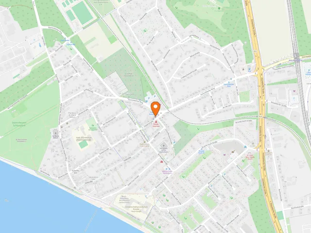
Map
Blue dots: other places nearby — tap to explore.
You might also like — related or nearby
Comments
- Loading comments…
Sources & links
Auto-generated, last verified: 2026-06-26
How this page is made
This page draws on open sources — Wikipedia, Wikidata, official websites and the city’s open data. Every statement is checked against the sources linked here, and pages are refreshed regularly.
Spotted a mistake anyway? Tell us below — we read every submission.