Rechtsrheinischer Kölner Randkanal
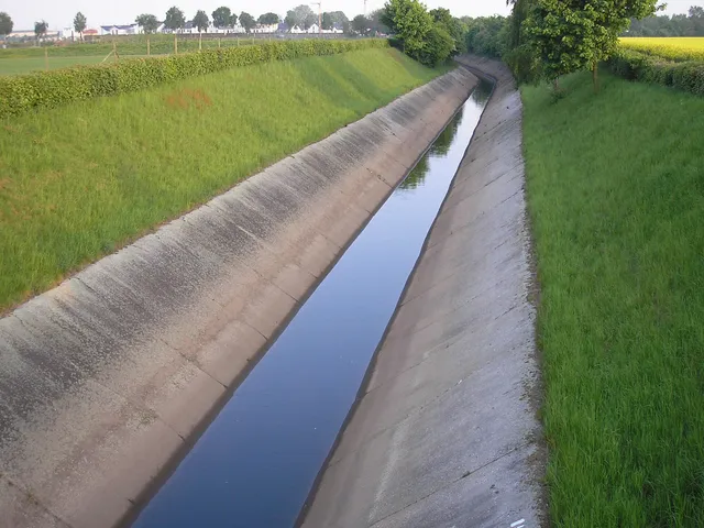
A twelve-kilometre underground relief canal that carries streams on the right bank of the Rhine from Bergisch Gladbach-Refrath all the way to Cologne-Stammheim, where they empty into the river.
Beneath the right bank of the Rhine runs a structure that leaves no trace on the surface: a twelve-kilometre canal that collects stream water before it can turn into a flooding problem. Its route runs from Bergisch Gladbach-Refrath to Cologne-Stammheim, where it discharges into the Rhine.
Source: Wikipedia
At a glance
- Length
- 12 kilometres
- Route
- Bergisch Gladbach-Refrath to Cologne-Stammheim
- Outlet
- Rhine
- Location
- entirely underground
- Purpose
- flood protection, relief canal for right-bank streams
- In operation since
- around 1985
Purpose and operation
The canal takes pressure off the streams on the right bank of the Rhine and thus helps prevent flooding. It is maintained by the Zweckverband Rechtsrheinischer Kölner Randkanal, a joint authority bringing together Cologne's municipal drainage utility (Stadtentwässerungsbetriebe Köln) and the Bergisch Gladbach wastewater works.
Route
Across its twelve kilometres, the canal never surfaces — running from Refrath in the south of Bergisch Gladbach to the Cologne district of Stammheim, where the water finally reaches the Rhine. It went into service around 1985.
Map
Blue dots: other places nearby — tap to explore.
You might also like — related or nearby
Comments
- Loading comments…
Sources & links
Auto-generated, last verified: 2026-07-15
How this page is made
This page draws on open sources — Wikipedia, Wikidata, official websites and the city’s open data. Every statement is checked against the sources linked here, and pages are refreshed regularly.
Spotted a mistake anyway? Tell us below — we read every submission.