Kölner Grüngürtel
Planned green zones that curve in a semicircle around Cologne on both banks of the Rhine, created from the city's former fortress grounds.
since 1923
The Cologne Green Belt is a system of planned green zones that curve in a semicircle around the city on both banks of the Rhine. It grew out of the former fortress grounds of Cologne's ring of fortifications.
Source: Wikipedia
At a Glance
- Origin
- former fortress grounds of Cologne's ring of fortifications
- Inner Green Belt
- about 7 km from the Rhine at Köln-Riehl to Luxemburger Straße, laid out mainly 1922–1924
- Outer Green Belt
- roughly 800 hectares, 400 of them forest; official opening on 16 September 1923
- Initiators
- Mayor Konrad Adenauer with urban planner Fritz Schumacher and garden director Fritz Encke
- Circular trail
- an approximately 65 km circular walking route through the Outer Green Belt (2014)
- Foundation
- the Kölner Grün Stiftung, founded in 2004 by Adenauer's grandsons
Things to do here
Age comparison
Age compared with other places in Cologne.
From Fortress to Park
After the Congress of Vienna, the Prussian military administration turned Cologne into a fortress city – on the left bank from 1816 to 1846, around Deutz from 1818 to 1863. In front of the bastions lay 14 forts and nine smaller lunettes, replaced from 1873 by an outer ring of eleven forts. Around 1900 Cologne was considered the largest fortress in the German Empire. Yet the fortifications blocked the urgently needed expansion of the city and were becoming militarily obsolete. In 1907 the city bought the fortress area from Prussia for 23 million Reichsmark. The inner fortress ring survived until the end of the First World War and was then razed under the Treaty of Versailles.
Adenauer's Vision
Mayor Konrad Adenauer recognised the value of a natural air filter for the growing city. He brought the Hamburg urban planner Fritz Schumacher and garden director Fritz Encke to Cologne; together they developed the idea of multifunctional green spaces. Following Schumacher's master development plan, the surroundings of the dismantled fortifications could be turned into parks – partly to prevent land speculation. From 1922 work began on green spaces and sports grounds, carried out during a time of high unemployment as a job-creation measure.
Inner and Outer Ring
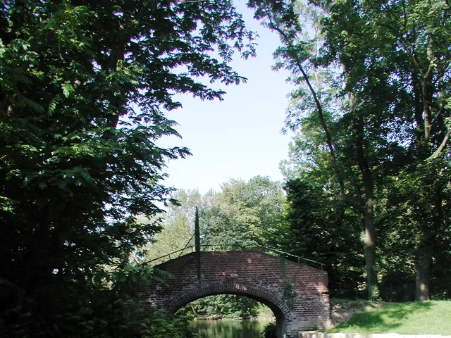
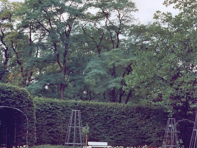
The Inner Green Belt runs about seven kilometres from the Rhine at Köln-Riehl to Luxemburger Straße; its landmarks include the Friedenspark around Fort I, the Rosengarten around Fort X and the four-hectare Aachener Weiher. The Outer Green Belt extends beyond the city limits of the time and covers around 800 hectares, 400 of them forest, threaded by the Militärring and accompanied by footpaths and cycle paths. Bodies of water such as the Decksteiner Weiher, the Kalscheurer Weiher and the Adenauerweiher are embedded within it.
Recreation and Ongoing Development
On the Decksteiner and Kalscheurer lakes visitors can go boating, and beside the Decksteiner Weiher there is a mini-golf course and dining options. In 2010 the Cologne forestry administration created the Waldlabor, an experimental site for forest development under climate change. The Kölner Grün Stiftung, founded in 2004, continues the vision of Adenauer and Schumacher with campaigns such as "1,000 benches for Cologne" and "1,000 trees for Cologne". Among the newer projects are the Landschaftspark Belvedere between Müngersdorf and Bocklemünd and the roughly 65 km circular walking trail, both added in 2014.
Gallery
Map
Blue dots: other places nearby — tap to explore.
You might also like — related or nearby
Comments
- Loading comments…
Sources & links
Auto-generated, last verified: 2026-07-08
How this page is made
This page draws on open sources — Wikipedia, Wikidata, official websites and the city’s open data. Every statement is checked against the sources linked here, and pages are refreshed regularly.
Spotted a mistake anyway? Tell us below — we read every submission.