Otto-Maigler-See
Hürth · Surrounding area of Cologne
Swimming lake formed in a former brown coal pit near Hürth, purpose-built with six side-by-side regatta lanes for international races and water sports.
The Otto-Maigler-See formed after brown coal extraction ended, as incoming groundwater filled a planned open-cast mining pit. It is one of the five approved bathing lakes in the Rhein-Erft district and was designed to accommodate six parallel regatta lanes.
Source: Wikipedia
At a Glance
- Type
- Former open-cast pit lake, fed by groundwater and regulated via overflow channels
- Location
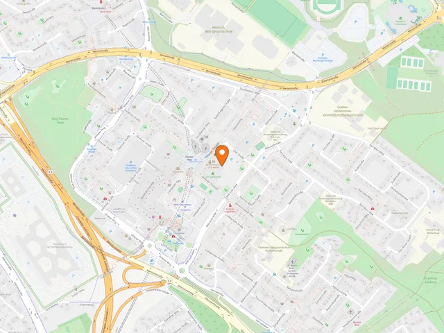
- Gotteshülfe mining field, town of Hürth, south-west of Cologne
- Open to the public since
- June 1977
- Shape
- Long and narrow, at the northern end of the Ville Lakes plateau
- Surroundings
- Set within 142 ha of forest; the grounds lie 30 m above the surrounding landscape
- Water sports
- Sailing, surfing, and rowing
Things to do here
Water area comparison
Water area compared with other lakes in Cologne.
Origins and Design
The reclamation plan traces back to the groundwork of Cologne landscape architect Victor Calles, who worked on rehabilitating the mining areas from 1946 and drew up a concrete plan for the site in 1961. The pit was originally divided by three clay ridges, which were removed to merge the areas into a single large lake, with a sandy bathing beach added on the north-west shore. A triple row of protective planting shields the surrounding farmland from westerly and south-westerly winds. The area is a designated landscape conservation zone and forms part of the Naturpark Rheinland.
The Name
Hürth's municipal council named the regatta lake in 1967 after Otto Maigler, the recently deceased director of Roddergrube AG. As a board member of Rheinbraun, Maigler had championed reforestation and land reclamation, and was involved in planning the resettlement of the Berrenrath district.
Wildlife and Flora
The lake serves as a staging and wintering site for various duck species and mute swans; cormorants and goldeneyes appear occasionally. As an angling water it is stocked with eel, pike, carp, tench, pike-perch, perch, and coarse fish. Protected plant species recorded include pondweeds and rigid hornwort. The shallow depth means wind keeps the water circulating year-round.
Swimming and Water Sports
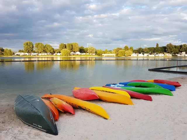
Stiftung Warentest rated the lake a recommended bathing water in 2008; during the swimming season the public health office tests the water for compliance with EU directives and bathing water regulations. Feeding the birds is prohibited, and aquatic vegetation is regularly trimmed by a mowing machine nicknamed the Seekuh ("lake cow"). A lido with a restaurant sits on the shore, hosting events on summer evenings. The Hürther Rudergesellschaft, founded in 1979, regularly stages international regattas on the parallel lanes, operating a boathouse above the eastern shore; the eastern section also serves as a surfing area.
Getting There
Visitors from Cologne can reach the lake via Berrenrather Straße and the cycle paths running through the Cologne Green Belt. A circular walking trail signposted from Alt-Hürth encircles the lake; the lido has a car park and is served by the Hürth local bus.
Did You Know
On 15 June 2018, DHL Paket employees set a Guinness World Record on the Otto-Maigler-See for the most people on a raft.
Map
You might also like — related or nearby
Comments
- Loading comments…
Sources & links
Auto-generated, last verified: 2026-06-30
How this page is made
This page draws on open sources — Wikipedia, Wikidata, official websites and the city’s open data. Every statement is checked against the sources linked here, and pages are refreshed regularly.
Spotted a mistake anyway? Tell us below — we read every submission.