Bleibtreusee
Erftstadt · Surrounding area of Cologne
Man-made lake from former lignite mining in the Ville, now a popular spot for water skiing, wakeboarding and swimming.
Bleibtreusee lies southwest of Cologne between Brühl and Hürth, one of many lakes left behind by lignite mining in the Rhineland region. Created in 1973, it is now part of the Rheinland Nature Park.
At a Glance
- Type
- Artificial lake from former open-cast lignite mining
- Location
- Central Ville, on the territory of Brühl and Hürth
- Size
- approx. 74 hectares
- Water
- nutrient-poor, calcareous still water with shallow zones
- Part of
- the Ville Lakes area, comprising over 40 lakes
- Activities
- water skiing, wakeboarding, stand-up paddleboarding, windsurfing, sailing dinghies, swimming, fishing, hiking
Things to do here
Water area comparison
Water area compared with other lakes in Cologne.
Name and History
The lake is named after Hermann Bleibtreu (1821–1881), a pioneer of the lignite industry in the Brühl area, who opened a mining field south of Heide in 1874 that later became the Gruhl works. Like all the lakes of the Ville Lakes area, Bleibtreusee was created by open-cast mining; the roughly 50 km² region includes mixed forests and more than 40 lakes.
Nature and Wildlife
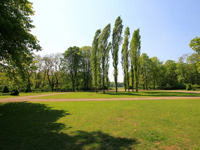
Following recultivation efforts by Rheinbraun and the landscape authority, a rich variety of plant and animal life has returned to the area. Mixed coniferous and deciduous forests, managed for forestry, surround the lake. The small elongated island at the southern edge is reserved for breeding birds and left in its natural state, providing protected nesting grounds for great crested grebes, kingfishers and moorhens. Beneath the surface, spiked water-milfoil has taken hold.
Recreation and Use
The Ville, the Kottenforst and the recultivated mining areas serve as a local recreation zone for the Cologne/Bonn region, with parts of the terrain designated as nature reserves. Windsurfers and small sailing dinghies are permitted in designated areas. Since July 2007, a water-ski facility with a restaurant has operated at the northern end, right next to a shallow sandy beach. It is run by Wasserski-Bleibtreusee GmbH & Co. KG, offering water skiing, wakeboarding and stand-up paddleboarding on a 580-metre circuit course plus a separate beginners' course (info, tickets and lessons via wasserski-bleibtreusee.de). Parking is available to the east, accessible via the B 265 or, from central Brühl, via the L 184. A former observation tower integrated into a high-voltage pylon was dismantled due to vandalism; only its base plate remains today.
Good to Know
A circuit of the lake covers about 5 km and takes roughly an hour. North of the island, the water reaches depths of up to 12 metres, though divers find it unappealing due to the dark lakebed. The channel southeast of the island is unsuitable for water sports because of fallen branches and shallow depth. In spring and autumn, the lake mainly attracts anglers, hikers and the occasional trail runner.
Map
Blue dots: other places nearby — tap to explore.
You might also like — related or nearby
Comments
- Loading comments…
Sources & links
- Official website
- Wikidata (retrieved 2026-06-30)
- Wikipedia (retrieved 2026-06-30, rev 267292347)
- Official website (retrieved 2026-08-16)
Auto-generated, last verified: 2026-08-16
How this page is made
This page draws on open sources — Wikipedia, Wikidata, official websites and the city’s open data. Every statement is checked against the sources linked here, and pages are refreshed regularly.
Spotted a mistake anyway? Tell us below — we read every submission.