Cologne-Rodenkirchen Rhine Bridge
Germany's first true suspension bridge: 567 m across the Rhine, opened in 1941 as the 'Adolf Hitler Bridge,' destroyed in WWII and rebuilt in 1954.
since 1941
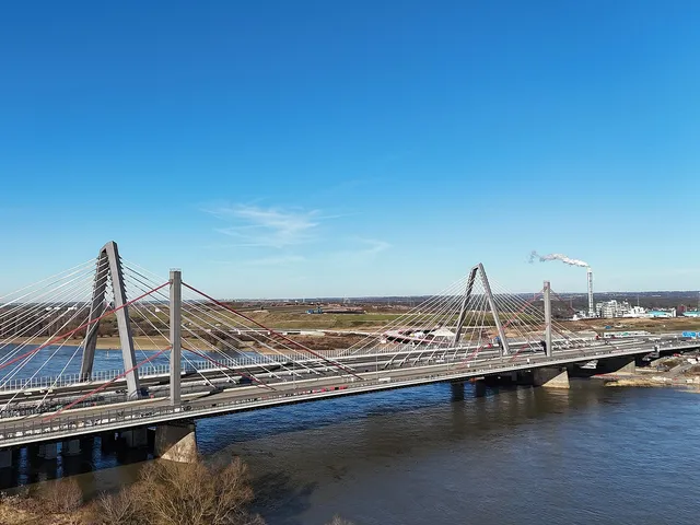
The Cologne-Rodenkirchen Rhine Bridge carries the A 4 motorway across the Rhine as a suspension bridge, connecting the left and right banks of Cologne's motorway ring road. It was Germany's first true suspension bridge and, at the time of its inauguration, the largest suspension bridge in Europe.
At a Glance
- Type
- Earth-anchored cable suspension bridge, part of the A 4 motorway
- Location
- Spans the Rhine at river kilometre 683.8, linking both banks
- Length
- 567 metres total span, with a 378-metre main span
- Pylons
- 59.4 metres tall
- Opened
- 20 September 1941
- Distinctive feature
- Painted in Cologne's signature bridge green
- Status
- Listed monument
When bridge engineer Fritz Leonhardt was drafted for military service on August 27, 1939, he remained a soldier for just two days – he was immediately recalled to the construction site because the bridge project was deemed a strategic military necessity.
Things to do here
Length comparison
Length compared with other Cologne bridges.
Age comparison
Age compared with other places in Cologne.
Planning and Construction
The bridge was designed by engineer Fritz Leonhardt, working alongside architect Paul Bonatz and engineer Karl Schaechterle as part of the Reichsautobahn Cologne–Aachen project. It was Leonhardt's first independent commission; he drew on knowledge of true suspension bridges he had acquired in the United States. Construction began on 1 March 1938, with the cables manufactured by the Cologne firm Felten & Guilleaume. At a cost of 13.9 million Reichsmarks and using 12,500 tonnes of steel, it became the most expensive completed structure on the Reichsautobahn network. Construction continued even after the outbreak of war — Leonhardt was recalled from military service just two days after his call-up. At its 1941 inauguration, the bridge bore the name 'Adolf Hitler Bridge.'
Destruction and Reconstruction
Following bomb strikes on 14 January 1945, the structure collapsed on 28 January 1945. Rebuilt between 1952 and 1954 to a new design by Hellmut Homberg, the reconstruction made use of the surviving pylons. Technical improvements — including a composite steel-and-concrete deck — saved more than 3,000 tonnes of steel compared to the original. The bridge reopened to traffic on 9 December 1954.
Widening
As traffic on the A 4 grew, the bridge was widened from four to six lanes between 1990 and 1994. A twin structure was added on the north side, sharing a central pier, with welded rather than riveted bridge elements. It opened on 9 December 1994 — exactly 40 years after the rebuilt bridge had first been put into service.
Architecture and Engineering
The bridge is defined by its gateway-like natural stone abutments, slender horizontal stiffening girders, and the interplay with the portal-shaped pylons, clad in shell limestone with granite added up to mid-water level on the piers. The stonework drawings were by Gerd Lohmer. The 1954 suspension cables measure approximately 50 centimetres in diameter, each comprising 61 individual wire ropes anchored in the ballast-weighted abutments. The current superstructure is an all-steel construction with 3.3-metre-deep stiffening girders.
Timeline
- 1. März 1938Construction of the Rhine Bridge Cologne-Rodenkirchen begins
- 11. November 1940Last deck girder installed
- 20. September 1941Inauguration as 'Adolf-Hitler-Brücke' – Germany's first true suspension bridge
- 14.–28. Januar 1945Bomb hits (14 Jan.) and collapse of the structure (28 Jan.)
- 1952–1954Reconstruction based on special design by Hellmut Homberg (cost: 17.2M DM)
- 9. Dezember 1954Bridge reopened to traffic
- 1990–1994Widening from 4 to 6 lanes (cost: 184M DM)
- 9. Dezember 1994Inauguration of the widening – exactly 40 years after the 1954 reopening
Map
Blue dots: other places nearby — tap to explore.
Address
A4
51105 Köln
Hours
So: 00:00–24:00
You might also like — related or nearby
Comments
- Loading comments…
Sources & links
Auto-generated, last verified: 2026-06-27
How this page is made
This page draws on open sources — Wikipedia, Wikidata, official websites and the city’s open data. Every statement is checked against the sources linked here, and pages are refreshed regularly.
Spotted a mistake anyway? Tell us below — we read every submission.