Ostfriedhof
Laid out in 1946 as a woodland cemetery, this roughly 59-hectare burial ground in right-bank Dellbrück is among the most scenic cemeteries in the Cologne area, dotted with mixed forest and Bronze Age burial mounds.
since 1946
The Ostfriedhof ("East Cemetery") is a central municipal cemetery on the right bank of the Rhine in Cologne, located in the district of Dellbrück near the Dellbrücker Mauspfad in the Mülheim borough. Conceived as an expansive woodland cemetery within the green belt, it offers not only graves but also wide, forested areas for walking.
At a Glance
- District
- Dellbrück, Mülheim borough (right bank of the Rhine)
- Established
- 1946, first burial in 1948
- Mourning hall
- completed 1955
- Area
- about 59 hectares, designed as a woodland cemetery
- Occupied graves
- around 20,000 (roughly a tenth of capacity)
- Notable feature
- anonymous urn burials beneath trees since March 2006
- Getting there
- bus route 154, stop "Ostfriedhof"
Age comparison
Age compared with other places in Cologne.
History and Layout
The cemetery was created in 1946 because the existing right-bank cemeteries were already running short of space. The first burial took place in 1948, while the mourning hall did not follow until 1955. The site was laid out in the right-bank green belt on partly wooded ground that forms an outlier of the nearby Königsforst.
Landscape and Use
At around 59 hectares the Ostfriedhof is generously sized, yet only about a tenth of its capacity is in use: with roughly 20,000 occupied graves, entire sections remain unused and overgrown with mixed forest. This makes it one of the most scenic cemeteries in the greater Cologne area – the open areas invite woodland walks and even mushroom foraging. As a result, the city of Cologne is considering removing unused stretches of forest from the cemetery and adding them to the adjoining municipal woodlands.
Bronze Age Burial Mounds
Several unoccupied grave fields show a gently undulating relief. This traces back to several hundred burial mounds that arose here from the 12th century BC onward, partly also in other right-bank areas of present-day Cologne. Estimates suggest around 1,200 mounds lie on the cemetery grounds alone – far more than have so far been documented. Surviving mounds can be seen, for example, near the main entrance and in section 43 close to the mourning hall.
Memorial and Notable Graves
In the north of the cemetery, on the Bensberger Marktweg, a memorial by Joseph Höntgesberg (1993) commemorates the forced labourers who had to work for the Radium company at the camp here from 1943 to 1945. The Ostfriedhof is also the final resting place of several well-known figures, including the painter Andreas Bliemel, the boxer Jupp Elze (section 18), the former Minister-President of North Rhine-Westphalia Heinz Kühn (section 29), and the American singer and music producer Jim Reeves.
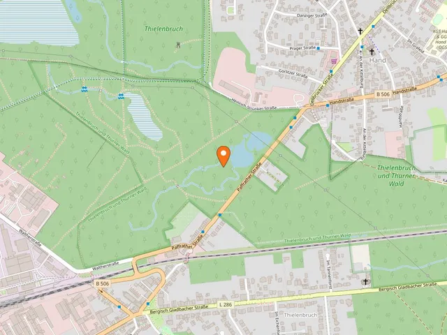
Map
Blue dots: other places nearby — tap to explore.
Address
Dellbrücker Mauspfad
51069 Köln
Hours
Mo: 07:00–20:00
Di: 07:00–20:00
Mi: 07:00–20:00
Do: 07:00–20:00
Fr: 07:00–20:00
Sa: 07:00–20:00
So: 07:00–20:00
Contact
You might also like — related or nearby
Comments
- Loading comments…
Sources & links
- Official website
- Official website (retrieved 2026-08-07)
- Wikidata (retrieved 2026-08-06)
- Wikipedia (retrieved 2026-08-06, rev 267911352)
Auto-generated, last verified: 2026-08-06
How this page is made
This page draws on open sources — Wikipedia, Wikidata, official websites and the city’s open data. Every statement is checked against the sources linked here, and pages are refreshed regularly.
Spotted a mistake anyway? Tell us below — we read every submission.