Frankenforstbach
Around 10 km long stream flowing from Bergisch Gladbach into right-bank Cologne, changing names several times before joining the Flehbach.
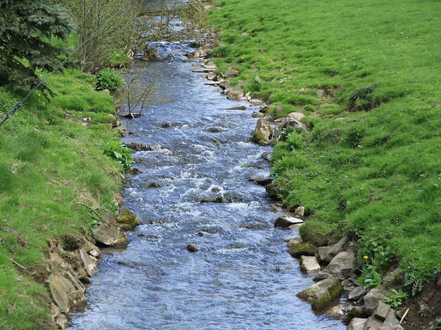
The Frankenforstbach winds for roughly 10 kilometres through the area of Bergisch Gladbach and the right-bank districts of Cologne. One of its most distinctive quirks is that it goes by several different names along the way.
Source: Wikipedia
At a Glance
- Type
- Stream
- Length
- approx. 10 kilometres
- Course
- from Bergisch Gladbach into right-bank Cologne
- Source
- Hundsiefen near Bensberg
- Mouth
- joins the Flehbach from the right, north of Frohnhof in Cologne-Merheim
- Catchment area
- 18.065 km²
- Location
- Merheim district, Kalk borough
In its lower course, the Frankenforstbach goes by four different names – Vürfelser Bach, Brücker Bach, Eggerbach, and Bruchbach – and was only artificially connected to the Flehbach in 1848, having previously simply seeped away in the Merheimer Bruch marshland.
Things to do here
- Follow the babbling stream through Frankenforst
- Watch nature at the quiet banks
- Get some fresh air on a walk along the water
- Photograph the little bridges and waterways
- Explore the stream up to where it meets the Flehbach
Course
The stream rises at the Hundsiefen near Bensberg and flows westward. At the L288 road it disappears into a culvert, passing through the Sonnenwinkel retention basin before continuing west through Frankenforst. Near Cologne-Merheim, north of the Frohnhof farmstead, it joins the Flehbach from the right; the two then continue together as the Faulbach towards Buchheim.
Names
Towards the end of its course the stream is known by several alternating names: Vürfelser Bach, Brücker Bach, Eggerbach, and finally Bruchbach. An older recorded name is Olifantbach, derived from the settlement of Olefant.
Catchment Area
The 18.065 km² catchment spans both the Bergisch upland plateaus and the Bergisch heath terraces. Its neighbours are the Strunde catchment to the north, the Flehbach and Sülz to the south, the Sülz to the east, and the receiving Faulbach elsewhere. Within the Bergisch Gladbach municipal area, residential development dominates the landscape. The only named tributary is the 7.2-kilometre-long Saaler Mühlenbach, which enters from the right near Hüttenfeld.
History
The Frankenforstbach once ended in the Merheimer Bruch marshland, where its water simply seeped away. In 1848 a connection to the Flehbach was created, giving the stream its present outlet.
Timeline
- 1848Frankenforstbach connected to the Flehbach (previously seeping away in the Merheimer Bruch)
Map
Blue dots: other places nearby — tap to explore.
You might also like — related or nearby
Comments
- Loading comments…
Sources & links
Auto-generated, last verified: 2026-06-26
How this page is made
This page draws on open sources — Wikipedia, Wikidata, official websites and the city’s open data. Every statement is checked against the sources linked here, and pages are refreshed regularly.
Spotted a mistake anyway? Tell us below — we read every submission.