Deutzer Gierponte
Historic cable ferry that linked Cologne-Deutz with the Old Town from 1674 to 1822 – no longer in existence today.
since 1674
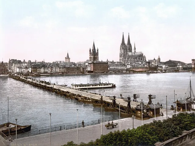
The Deutzer Gierponte, also known as the Schiffbrücke ("ship bridge"), was a reaction cable ferry that crossed the Rhine between Cologne-Deutz and the Cologne Old Town from 1674 to 1822. The floating structure no longer exists today.
Source: Wikipedia
At a Glance
- Type
- Reaction cable ferry (floating ship bridge)
- Period
- 1674 to 1822, in service for almost 150 years
- Location
- between Cologne-Deutz and the Cologne Old Town
- Construction
- catamaran form built from two supporting ship hulls
- Model
- the Nijmegen design developed by Hendrick Heuck
- Capacity
- up to 500 people and 100 horses per crossing
- Notable feature
- driven solely by the river current, using the reaction-ferry principle
Things to do here
Age comparison
Age compared with other places in Cologne.
History
The ferry's origins lie in the Franco-Dutch War. Following the siege of Bonn, troops of the Holy Roman Empire under the imperial commander Raimondo Montecuccoli captured the Electoral Cologne city – allied with the French – in November 1673. The following year, the imperial general Margrave Hermann of Baden had the captured Bonn cable ferry brought to Cologne in order to cross the Rhine there.
He first offered the ferry to the Free Imperial City of Cologne. After the city declined, he sold the Gierponte to the Deutz ferry vassals for 1,300 thalers. In return, they committed to transporting imperial troops across the river at any time. The Cologne council, however, insisted that the ferry be moored on the left bank of the Rhine overnight.
Operation and Capacity
According to the Deutz bridge regulations of 1690, the Gierponte had to run at least twice per hour. A single crossing took between 15 and 20 minutes and could carry up to 500 people and 100 horses. The ferry was operated by a bridge master and four additional crew members.
Between 3 March 1791 and 29 July 1793, operations ran along a different route: a dispute between the citizens of Cologne and Deutz meant that during this period the ship bridge ran between Poll on the right bank and a landing near the Bayenturm on Cologne territory.
Construction
The Deutzer Gierponte followed the Nijmegen model, which went back to the cable ferry developed by Hendrick Heuck and had already enabled Rhine crossings there from 1657. Two supporting ship hulls, almost 40 metres long (110 feet in the measurement of the time) and 4 metres wide, gave the structure its catamaran form. On top of them rested a load-bearing transport surface of nearly 320 square metres. Two crossed wooden struts provided reinforcement.
Around the middle of the 18th century, the ferry's guiding frame was upgraded, gaining a double crossbar, a strut framework, and lee boards.
The End
After nearly 150 years of service, the era of the floating ferry came to a close. At the end of 1822, the Prussian administration built the Deutzer Schiffbrücke, a fixed, permanent pontoon bridge that replaced the Gierponte. The Deutzer Gierponte has not survived to the present day, so it can only be explored through its history.
Map
Blue dots: other places nearby — tap to explore.
You might also like — related or nearby


Comments
- Loading comments…
Sources & links
Auto-generated, last verified: 2026-07-10
How this page is made
This page draws on open sources — Wikipedia, Wikidata, official websites and the city’s open data. Every statement is checked against the sources linked here, and pages are refreshed regularly.
Spotted a mistake anyway? Tell us below — we read every submission.