Monte Troodelöh
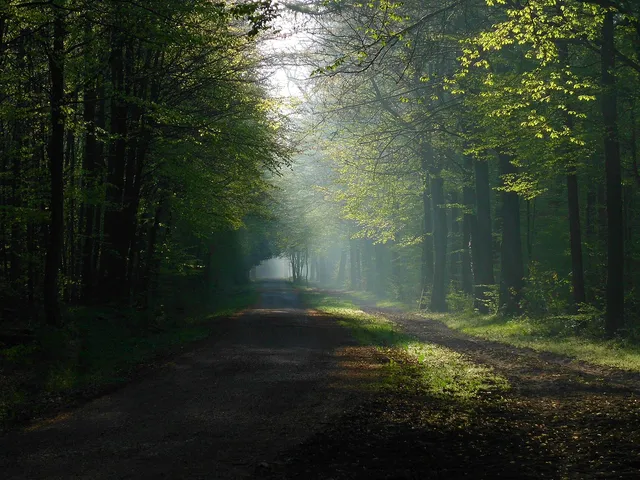
Cologne's highest natural point hides in the Königsforst: a wooded slope with a boulder, a summit plaque and a summit book – a popular hiking destination with a tongue-in-cheek invented name.
At 118.04 m above sea level (NHN), Monte Troodelöh is the highest natural elevation in the city of Cologne. It lies in the Königsforst forest in the Rath/Heumar district and is a popular hiking destination featuring a boulder, a summit plaque and a summit book.
At a Glance
- Elevation
- 118.04 m above sea level (NHN) – Cologne's highest point
- Location/district
- Königsforst forest, Rath/Heumar district, on the Wolfsweg
- Origin of the name
- an invented word from the surnames of its three „discoverers“ Troost, Dedden and Löhmer
- Character
- a wooded slope with no view and no refreshments
- Facilities
- a boulder with an explanatory bronze plaque and a compartment for a summit book
- Admission
- freely accessible in the forest
Location
The elevation lies in Cologne's Rath/Heumar district, about 1,250 metres as the crow flies south of the A 4 motorway. It sits on the Wolfsweg between the junction with the Pionier-Hütten-Weg and the crossing with the Brück-Forsbacher Weg, on a rising slope in the Königsforst. To the east, above the Wolfsweg, the terrain continues to climb to around 130 metres (Großer Steinberg); that area, however, already belongs to the Bensberg district of the town of Bergisch Gladbach, as the Wolfsweg forms the boundary of Cologne's city territory there.
Naming
In November 1999 a group of employees of the Cologne city administration hiked up to what was then still recorded as the 116.7 m NHN and largely unknown highest elevation of Cologne, setting up a provisional summit cross there. After the municipal Office for Real Estate, Surveying and Cadastre re-surveyed the area in 2000, the height was corrected to the 118.04 m NHN that remains valid today.
In 2001, under the leadership of the Rhineland-Cologne section of the German Alpine Club, a new summit cross was installed with a bronze plaque recording the actual height. Shortly afterwards the forestry administration replaced the cross with a boulder, which now bears the plaque. That same year the spot received its name following a competition in the city staff newsletter – combining the surnames of its three „discoverers“ Troost, Dedden and Löhmer.
As a Hiking Destination
Today Monte Troodelöh features in numerous suggested routes in local hiking and Cologne guidebooks and is regarded as a sight worth seeing – even though it offers neither a view nor any catering. At the boulder there is an explanatory bronze plaque and a compartment for a summit book in which hikers who have reached the spot can sign in. The summit book has had to be replaced several times after acts of vandalism. Fourteen fully written volumes (as of April 2024) are kept in the Historical Archive of the City of Cologne.
Trivia
The spot is mentioned in the song „Mer sin Eins“ by the Cologne band Kasalla – in the same line as the Pletschbach, a usually dry tributary of the Rhine in Worringen.
Map
Blue dots: other places nearby — tap to explore.
Address
Monte Troodelöh
51109 Köln
You might also like — related or nearby
Comments
- Loading comments…
Sources & links
Auto-generated, last verified: 2026-08-08
How this page is made
This page draws on open sources — Wikipedia, Wikidata, official websites and the city’s open data. Every statement is checked against the sources linked here, and pages are refreshed regularly.
Spotted a mistake anyway? Tell us below — we read every submission.