Ebertplatz
Square on Cologne's ring boulevards in Neustadt-Nord, laid out in the late 19th century where the city's demolished fortifications once stood.
Located in Cologne's Neustadt-Nord district, Ebertplatz connects the Hansaring with the Theodor-Heuss-Ring — the last of the city's ten ring sections. Among the inner-city ring boulevards, it is the largest in terms of area.
At a Glance
- Type
- Square on the Cologne ring boulevards
- Former name
- Deutscher Platz (from 27 January 1887)
- Previous use
- Inner fortification ring; a harbour basin once stood on this site
- Open land after demolition
- 104 hectares
- Former park
- Pond with three fountains across 6.2 hectares
- Notable feature
- Art Nouveau buildings with dome-crowned corner towers
Before the Ebertplatz was created, the site was occupied by a winter harbour commissioned by Napoleon in 1811 – nearly 500 metres long and 50 metres wide – which silted up due to various planning failures and was not filled in until 1890.
Things to do here
- Stroll across the spacious ring boulevard square
- Admire the Art Nouveau buildings with their dome-topped corner towers
- Photograph the architecture and façades
- Wander along the Cologne Ring road toward Hansaring or Theodor-Heuss-Ring
- Rest on a bench and watch the bustle of the square
From Fortress Belt to Boulevard
Originally part of the inner fortification belt, the site passed into city ownership when the purchase agreement between Cologne and the Prussian War Ministry took effect on 5 May 1881. For 11.74 million marks, the city acquired the land, had the fortifications demolished, and gained 104 hectares of open space. The planned grand boulevard drew inspiration from the Parisian Grands Boulevards and Vienna's Ringstraße.
Planning and Layout
Joseph Stübben and Karl Henrici won the city of Cologne's urban expansion competition, and the square took shape according to their designs in the late 19th century. Stübben envisioned a semicircular ring boulevard running along the line of the old city wall, stretching from the present-day Ubierring to the Rhine. Where several streets converged, the city chose a generous open square over a simple intersection. It was named Deutscher Platz — the central point of the simultaneously renamed Deutscher Ring — on 27 January 1887.
Park and Development
The plans called for a park with a fountain basin and pond. From 1888, Adolf Kowallek laid out gardens stretching from the Rhine to Deutscher Platz; around 1891 a 6.2-hectare pond with three fountains was added between Neusser Straße and Riehler Straße. Residential and commercial buildings along the northern ring section arrived after 1888, with the corner building at Ebertplatz 1 / Sudermanstraße not completed until 1900. Many of the Art Nouveau houses are defined by their dome-crowned corner towers.
The Former Harbour
Plans for a safety harbour on this site circulated as early as 1786, and the decision to build was taken on 24 November 1810. From 1811, a winter and safety harbour — nearly 500 metres long and 50 metres wide — was constructed to protect against ice drift and flooding. Known as the "Napoleonshafen" or "Thürmchenshafen", it gradually silted up from 1840 onwards, fell into disuse, and was finally filled in in 1890.
Timeline
- 1811Construction of Napoleonhafen decided Nov 1810, work began 2 April 1811
- 1813Napoleonhafen opens
- 1881City of Cologne acquires the area for 11.74 million marks (5 May 1881)
- 1885Urban alignment plan no. 30 approved for the square (Sept. 1885)
- 1887Square named 'Deutscher Platz' on 27 January 1887
- 1890Napoleonhafen filled in; garden with pond completed around 1891
- 1900Last building at corner Ebertplatz 1/Sudermanstraße completed
- 1903Unveiling of Kaiser Friedrich III monument on 1 October 1903
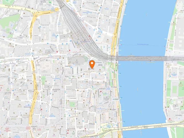
Map
Blue dots: other places nearby — tap to explore.
Address
Ebertpl.
50668 Köln
You might also like — related or nearby
Comments
- Loading comments…
Sources & links
Auto-generated, last verified: 2026-06-26
How this page is made
This page draws on open sources — Wikipedia, Wikidata, official websites and the city’s open data. Every statement is checked against the sources linked here, and pages are refreshed regularly.
Spotted a mistake anyway? Tell us below — we read every submission.