Schmitz Column
A sculpture in Cologne's Old Town in front of Great St. Martin Church that marks the city's 50-metre elevation point and playfully commemorates the Schmitz family and the Moon landing.
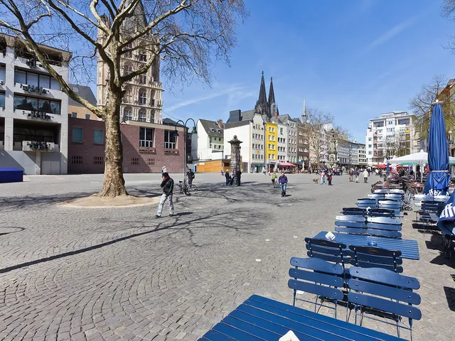
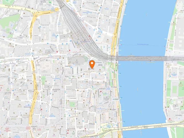
The Schmitz Column stands in Cologne's Old Town, west of Great St. Martin Church on the square An Groß St. Martin, framed by Lintgasse and Brigittengäßchen and close to the Alter Markt. The sculpture marks Cologne's 50-metre elevation point.
At a Glance
- Type
- Sculpture / column
- Height
- about 4.50 metres
- Base area
- roughly 90 × 90 cm
- Material
- natural stone on a concrete base
- Donated
- 1965 by architect Jupp Engels
- Inaugurated
- 1969
- Location
- An Groß St. Martin square, Old Town
History
The column was donated in 1965 by the Cologne architect Jupp Engels (1909–1991), known for his engagement with the city's history, and was inaugurated in 1969. It is made of natural stone on a concrete base, possibly incorporating stones from the Roman harbour buildings that once stood roughly at this spot.
According to an inscription, the stones used were excavated in 1962 at the Haus Em Hahne on the Alter Markt and originate from Roman harbour structures on the former Martins Island.
The Schmitz Legend
Today's Martin's Quarter between the Alter Markt and the Rhine was an island in Roman times, lying between the main branch and a western side branch of the Rhine. It held Roman warehouses belonging to the harbour as well as a Roman bath; the side branch was filled in shortly before the year 1000, giving rise to today's Alter Markt and Heumarkt.
A Cologne legend holds that Roman soldiers met young Ubii women while bathing on this Martins Island, and that the Schmitz family descends from such a union. "Schmitz" is the most common surname in the Rhineland, and those who bear it are jokingly regarded as "Rhenish nobility".
Flood and Moon Landing
The column marks the height of the ice flood of 28 February 1784, which destroyed large parts of the then still independent town of Mülheim.
The base also commemorates the Apollo 11 Moon landing, when Neil Armstrong became the first person to set foot on the Moon on 21 July 1969. On behalf of the donor, scientists in Bochum calculated the exact distance from the column to the lunar surface: 389,994 kilometres and 100 metres. City guide Uli Kievernagel sees it as a sign of "Cologne megalomania" that the column's inauguration during the "Moon fever" of 1969 was meant to appear at least equal to the Moon landing itself.
Good to Know
The inscriptions are spread across the column's four sides: the north side bears the 50-metre mark and the flood mark, the west side tells of Martins Island and the ancestors of the Schmitz family, the south side is devoted to the Moon landing, and the east side notes that the stones come from the Roman harbour buildings.
Gallery
Map
Blue dots: other places nearby — tap to explore.
Address
An Groß St. Martin
Köln
Hours
So: 00:00–24:00
You might also like — related or nearby


Comments
- Loading comments…
Sources & links
Auto-generated, last verified: 2026-07-11
How this page is made
This page draws on open sources — Wikipedia, Wikidata, official websites and the city’s open data. Every statement is checked against the sources linked here, and pages are refreshed regularly.
Spotted a mistake anyway? Tell us below — we read every submission.