The Kahlenhausen or Jews' Gate (Judenpforte)
A short-lived medieval gate in the north-eastern stretch of Cologne's city wall between the Eigelstein gate and the Kunibert tower, recorded in 1349 as the "porta judeorum" and no longer preserved today.
Between the Eigelstein gate and the Kunibert tower, the narrow Kahlenhausen or Jews' Gate once pierced Cologne's medieval city wall. It appears in the city's Schreinsbücher (property registers) in 1349 as the "porta judeorum", but survived as a gate only briefly.
Source: Wikipedia
At a Glance
- What
- A vanished gate of Cologne's medieval city wall
- Location
- North-eastern wall section between the Eigelstein gate and the Kunibert tower (Niederich suburb)
- First recorded as "porta judeorum"
- 1349, in the city property registers
- Building material
- Columnar basalt, with an ashlar passage
- Passage
- Pointed-arch, only 2.75 m wide, 5.00 m high at the apex
- Presumably walled up
- by around 1446
- Today
- Not preserved; the street name "Unter Kahlenhausen" recalls its site
Location and Hinterland
The gate stood in the north-eastern suburb of Niederich, where the arable, vineyard and garden land known as "Kaldenhuysen" and later Kahlenhausen adjoined the Türmchenwall on the city side. A new ditch in front of "Caldenhusen" was already mentioned in 1239.
At first the area was only sparsely built up, dotted with a few farmsteads. These holdings mostly belonged to the collegiate foundations or to families of Cologne's patriciate. A register entry of 1405, for example, names a farmstead formerly called "dat Kelderhus", once owned by the knight Werner vom Spiegel and later held by the alderman Goebel Hardevust. Families such as the vom Schiederich, vom Spiegel and Hardevust already provided the city's mayors in the 14th century.
Used for agriculture, Kahlenhausen remained thinly settled well into the modern era. The "Calhauser gaß" that led up to the gate corresponds to today's street "Unter Kahlenhausen".
The Structure
Built of columnar basalt, the gate had a narrow passage matching the tight lane. It was formed as a pointed arch of ashlar, measured only 2.75 m in width and reached an apex height of 5.00 m.
The gate was flanked to the west by a semicircular defensive tower of the wall, and to the east by a projection containing a smaller passage to the rampart. Like many other gate buildings, it carried a wooden throwing gallery above the gate on the field side. The structure was framed by the city wall, built of tuff in brick form and set at regular intervals with semicircular defensive towers. The tower following it towards the Eigelstein was equipped with a projecting "throwing nose" and was probably regarded as a so-called fighting house, known in medieval Cologne as a Wichhus.
The Name "Jews' Gate" and Its End as a Gate
The gate was probably one of the last to be built in the great ring wall. A register document of 1262 describes the older Jews' gate on Zeughausstraße as the "antiqua porta", which had likewise been assigned to the Jews for defence during the expansion of the fortifications in 1106.
In 1349, driven in part by the raging plague, renewed attacks on Cologne's Jewish inhabitants took place, culminating in murder, expropriation and expulsion. With the council's approval, these events continued into the 1370s; from 1372 the council again pursued a more moderate policy. It may be assumed that from 1349 the Jews were relieved of responsibility for the Kahlenhausen defensive section. For 1371 the city accounts record the entry "vigilantes up der Juden Wichhuss", showing that the town militia guarded this stretch.
As a gate the passage had only a short life and was evidently already walled up by 1446: the record of a watch allocation for that year mentions only the section's "Judenwichhaus", no longer a gate or portal. The name "Juden Wichhuss" persisted as a designation carried over from the past that no longer matched reality; it still appears in 1475 ("Wacht auf der Juden Wichhuys") and again in 1560. By 1582 the name is absent altogether, the record now speaking of "six field towers between the Eigelstein gate and St. Cunibert". The final expulsion of the Jews, decided by the council in 1423, was carried out in 1424 amid pogroms.
From Bastion to Disappearance
On Arnold Mercator's map nothing of the Kahlenhausen gate can be made out, though a growing density of building in the quarter is visible. In the 17th century, during the Thirty Years' War, the city reinforced its fortifications and provided the wall section in front of Kahlenhausen with a small bastion. This change is said to be recognisable in the drawings of Hollar and Merian (1646); with it, the references to Kahlenhausen's fortifications come to an end.
Towards the end of the 19th century, urban expansion made demolition unavoidable. In 1882 the levelling of the bastions began, followed section by section by the taking down of the city wall. As the Neustadt-Nord quarter took shape, the Türmchenwall was also built up on its north-west side. The street Unter Kahlenhausen was later continued by the newly created Clever Straße, which led to the Deutscher Ring (today the Theodor-Heuss-Ring).
Today
Nothing of the Kahlenhausen or Jews' Gate survives. The gate was removed at the latest during the demolition of the city wall in the late 19th century. Its former site is still recalled by the street name "Unter Kahlenhausen", which goes back to the earlier "Calhauser gaß".
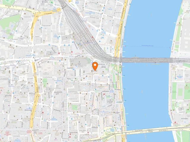
Map
Blue dots: other places nearby — tap to explore.
You might also like — related or nearby
Comments
- Loading comments…
Sources & links
Auto-generated, last verified: 2026-08-24
How this page is made
This page draws on open sources — Wikipedia, Wikidata, official websites and the city’s open data. Every statement is checked against the sources linked here, and pages are refreshed regularly.
Spotted a mistake anyway? Tell us below — we read every submission.