Flehbach
A right-bank Rhine tributary with highly variable flow — swollen after rain, yet sometimes bone-dry in summer.
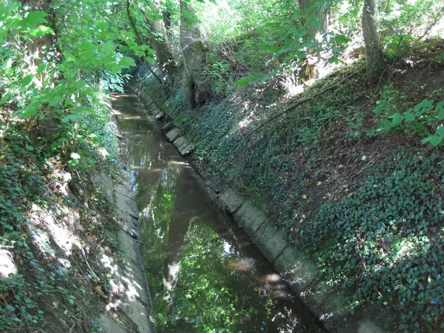
The Flehbach is a right-bank tributary of the Rhine whose water levels fluctuate dramatically: heavy rainfall swells it considerably, while a stretch of dry summer weather can leave it completely dry.
Source: Wikipedia
At a Glance
- Type
- Right-bank tributary of the Rhine
- Length
- Just under 17 km
- Course
- Rheinisch-Bergischer Kreis and Cologne
- Catchment area
- 76.785 km²
- District
- Mülheim
- Distinctive feature
- Can run completely dry in summer
Originally, the Flehbach flowed through Mülheim all the way to Wiesdorf – due to persistent flooding, it was redirected in the early 19th century through an artificially dug channel directly into the Rhine.
Things to do here
- Stroll along the streamside
- Watch the nature along the banks
- Discover the changing water level
- Photograph idyllic stream scenes
- Walk in the footsteps of the old watermills
Course
The stream is fed by several headwaters, most of which rise on the north-western slopes of the Tütberg within the municipal area of Bergisch Gladbach. The Kleine Wahlbach is considered the main channel, supplemented by the Wahlbach and Holzerbach tributaries; from the north, the Böttcherbach — rising near Moitzfeld — joins the flow. For roughly 2 km the Flehbach forms the boundary between Bergisch Gladbach and Cologne. In the Gladbach district of Lustheide it passes north of the Bethanien children's village. Through Cologne-Brück it runs alongside Flehbachstraße, the road named after it. In Cologne-Merheim it merges with the Bruchbach to form the Faulbach, which reaches the Rhine through a culvert.
Flooding and Drought
Historically, the stream — when running high — flooded Cologne-Rath, a neighbourhood situated on a former Rhine channel. Flow is now regulated by the Flehbachdamm in the Königsforst, supplemented by smaller overflow basins further downstream.
History
The Flehbach once powered several water mills. Of the Flehbachmühle only the street name Flehbachmühlenweg in Lustheide survives; at the Erkermühle behind the Flehbachdamm, the mill pond has been preserved. In Mülheim the stream originally ran towards Düsseldorfer Straße and on to Wiesdorf. To combat flooding, it was redirected at the beginning of the 19th century through an artificially constructed channel leading directly into the Rhine.
Catchment Area
The catchment stretches from the Bensberg-Forsbach highland fringe across the Paffrather limestone terrace to the Mülheim Rhine plain, draining via the Faulbach and the Rhine to the North Sea.
Timeline
- Anfang 19. JahrhundertStream redirected via artificial channel in Mülheim directly to the Rhine
Map
Blue dots: other places nearby — tap to explore.
You might also like — related or nearby
Comments
- Loading comments…
Sources & links
Auto-generated, last verified: 2026-06-26
How this page is made
This page draws on open sources — Wikipedia, Wikidata, official websites and the city’s open data. Every statement is checked against the sources linked here, and pages are refreshed regularly.
Spotted a mistake anyway? Tell us below — we read every submission.