The South-West Gate of the Colonia Claudia Ara Agrippinensium
A vanished Roman city gate on Clemensstraße in southern Cologne that once formed the south-western exit of the fortified Roman town.
Where Clemensstraße meets Bobstraße once stood one of the city gates of the Colonia Claudia Ara Agrippinensium. Some sources also record it as the "Eifel Gate" or the "Gate of Clemensstraße"; nothing of it survives above ground today.
Source: Wikipedia
At a Glance
- Type
- Vanished Roman city gate (double gateway)
- Location
- Near Clemensstraße/Bobstraße, southern Cologne old town
- Date
- Roman period, part of the 1st-century AD city fortifications
- Function
- South-western exit of the Roman town towards Trier
- Openings
- Two passages – a carriageway (around 3.70 m) and a pedestrian passage (about 2.60 m)
- Alternative name
- Eifel Gate or Gate of Clemensstraße
- Successor
- The Griechenpforte, built after the gate lost its role
A Largely Forgotten Gate
The structure was one of probably nine gate buildings of the fortified town – eight gates and one gate tower – three of which stood along the western wall. Its history long remained obscure: for centuries after the Roman era, well into the early Middle Ages, it is no longer mentioned in the sources. Along the wall it sat between the rounded bastion at the later Griechenpforte and the central western gateway, a forerunner of the Hahnentorburg that was later pushed far to the west.
The Road to Trier
Like every city gate, it marked the beginning and end of a road. From the south-east of the town an east–west route ran via Sternengasse and Agrippastraße towards the south-western paved way. Beyond the gate the road continued in a straight line – in the alignment of today's Huhnsgasse and Weyerstraße – onto the military road later called Zülpicher Straße, which only in Prussian times received its present name of Luxemburger Straße. After passing one of the Roman cemeteries outside the walls, it reached open country and followed the straight course of the Roman road through the Eifel to Augusta Treverorum (Trier) and on towards Lyon.
The Archaeological Findings
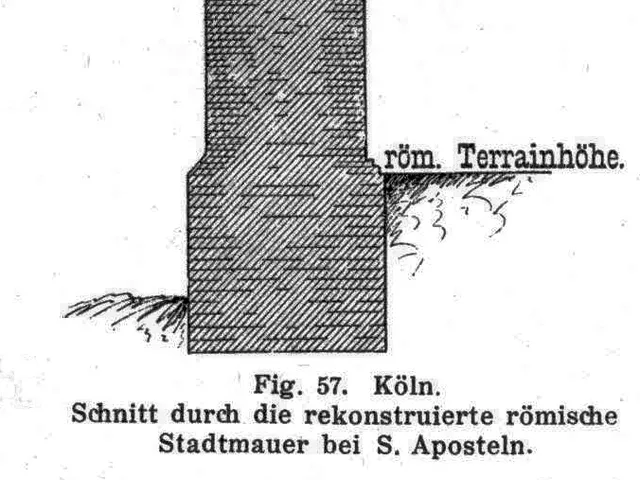
Foundations of the gate were uncovered in Clemensstraße at the height of Bobstraße. Their material and construction matched the adjoining remains of the Roman city wall, allowing a clear attribution. Two side walls facing the town, roughly 3.05 m and 3.00 m thick, together with a central pier about 3.90 m in diameter, formed the two passages. Rectangular foundation projections between the city wall and the side walls were interpreted as the substructures of stairways; beneath the southern ascent a clay pipe channel of about 0.265 m in diameter carried waste water outward. The southern passage had later been blocked with greywacke, trachyte, sandstone and brick fragments – meaning the gate had lost its role as an important traffic route.
Roman Traces Nearby
The ground around the gate was rich in Roman remains. To the south, beside the bastion, the foundations of a Jupiter temple measuring roughly 10 × 10 m came to light in 1891, complete with a cult image and two altars. Right at the gate, at the corner of Clemensstraße and Bobstraße, the torso of a colossal statue of an enthroned Jupiter of the Rhenish type was recovered. Slightly more than one leuga away – the Gallic measure of some 2,200 metres – a red sandstone milestone was found on Luxemburger Straße in 1903, dating from 293 to 305 AD and bearing a dedicatory inscription to the emperors Constantius and Maximianus.
From Main Gate to Griechenpforte
In the western suburb the Abbey of St. Pantaleon held the largest share of land. Around 1144 a Benedictine convent, subordinate to St. Pantaleon, was built on the ground in front of the wall, blocking the long-established route into the south-western suburb – which was also the start of the road to Trier. As a replacement for the abandoned gate, the Griechenpforte (porta Grecorum) was then built, and it is described in its own entry.
Map
Blue dots: other places nearby — tap to explore.
You might also like — related or nearby
Comments
- Loading comments…
Sources & links
Auto-generated, last verified: 2026-08-23
How this page is made
This page draws on open sources — Wikipedia, Wikidata, official websites and the city’s open data. Every statement is checked against the sources linked here, and pages are refreshed regularly.
Spotted a mistake anyway? Tell us below — we read every submission.