Indianersiedlung Zollstock
A resident likened it to an Indian reservation: this maverick Zollstock estate was built in the late 1920s for large families of the unemployed.
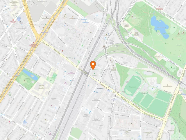
Nicknamed "Minnesota in Köln", the settlement lies tucked between the Eifeltor freight yard and the Südfriedhof cemetery.
Source: Wikipedia
At a Glance
- Location
- Zollstock district, Rodenkirchen borough, Cologne
- Buildings
- highly individual, self-built houses
- Access
- via Kalscheurer Weg
- Owner
- Genossenschaft Kalscheurer Weg eG (housing cooperative)
- Surroundings
- residential area to the north, allotment gardens to the south
The name "Indianersiedlung" (Indian settlement) was coined by journalist Hans Conrad Zander, who lived there himself: after visiting a Native American reservation in North America, he found the Cologne settlement similarly unconventional. It arose in the late 1920s when Mayor Konrad Adenauer allotted building land to large families of the unemployed, who lost their building rights if they did not start building within a year.
A Name from North America
The term "Indianersiedlung" goes back to Hans Conrad Zander, a journalist and author who lived in the settlement himself. On his travels through North America he had visited an Indian reservation, and he found the Zollstock estate similarly unconventional. The name has stuck ever since, not least because the settlement still has a rather wild, idiosyncratic character.
Building Land with a One-Year Deadline
The settlement was based on the emergency decrees of Reich Chancellor Heinrich Brüning. Cologne's mayor, Konrad Adenauer, then made land available to large families of the unemployed so they could build their own homes. Among these sites was the Oberer Komarweg temporary settlement area, where plots were allocated. Families received building permits and had to meet only a few requirements, such as a concrete cesspit or barrels for collecting rainwater. Anyone who had not begun building within a year lost the right to build. As a result, many houses turned out highly individual.
New Residents and Averted Cemetery Plans
After the Second World War, refugees moved into the settlement. Later, students from the alternative scene settled here as well. In 1978, a change to the land-use plan put the settlement at risk, as an extension of the Südfriedhof was planned in its place. Those plans were ultimately averted.
Paths Through the Settlement
Narrow cul-de-sacs branch off Kalscheurer Weg at right angles and cross the settlement. They are designated Kalscheurer Weg S, ST, T, U, V and W. The allotment gardens on the southern edge in turn border the outer green belt.
Cooperative and Expansion Plans
In the late 1990s, the Genossenschaft Kalscheurer Weg eG bought the site from Deutsche Bahn and has owned it ever since. It plans to expand the settlement with just over 100 social housing units. A daycare centre with five groups is also planned.
Timeline
- Ende der 1920erSettlement founded; Adenauer allots building land to large unemployed families
- 1978Land-use plan change threatens settlement (cemetery extension); averted
- Ende der 1990erKalscheurer Weg cooperative buys the site from Deutsche Bahn
Gallery
Map
Blue dots: other places nearby — tap to explore.
You might also like — related or nearby
Comments
- Loading comments…
Sources & links
Auto-generated, last verified: 2026-10-21
How this page is made
This page draws on open sources — Wikipedia, Wikidata, official websites and the city’s open data. Every statement is checked against the sources linked here, and pages are refreshed regularly.
Spotted a mistake anyway? Tell us below — we read every submission.