Köln Frankfurter Straße Station
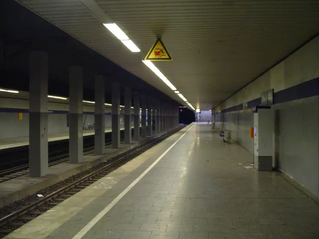
Station on Cologne's airport loop: trains stop on a bridge over Frankfurter Straße, mainly serving the AirportBusinesspark in Gremberghoven.
The station takes its name from Frankfurter Straße, which crosses the railway lines here and forms part of Federal Road 8 (B 8).
At a Glance
- Type
- Passenger station and junction
- Location
- Gremberghoven district, Porz borough
- Lines
- Agger Valley Railway and the airport loop
- Opened
- 12 June 2004
- Services
- S-Bahn line S 19 and the Oberbergische Bahn (RB 25), run as a pre-S-Bahn service
During construction of the Cologne airport loop, Frankfurter Straße was lowered by about seven meters; at the same time, the station in the center of Gremberghoven was closed, so the district's center can now only be reached by bus.
Built with the Airport Loop
The station opened together with the Cologne airport loop. For construction, Frankfurter Straße was lowered by about seven metres and rerouted while work was under way. In connection with this, the Gremberghoven station on the Sieg line in the centre of the district was closed. In its place, the Köln Airport-Businesspark and Köln Steinstraße stops were added on that line, the latter already opened in 2003. Since then, the centre of Gremberghoven has been reachable only by bus.
Platform and Access
The bridge carries two long-distance tracks and two S-Bahn tracks, with an island platform serving the S-Bahn tracks. Stairs lead up from both sides of Frankfurter Straße and from the business park. At the S-Bahn standard height of 96 cm, the platform allows step-free access to S-Bahn trains. A lift also connects to Frankfurter Straße.
Surroundings and Bus Connections
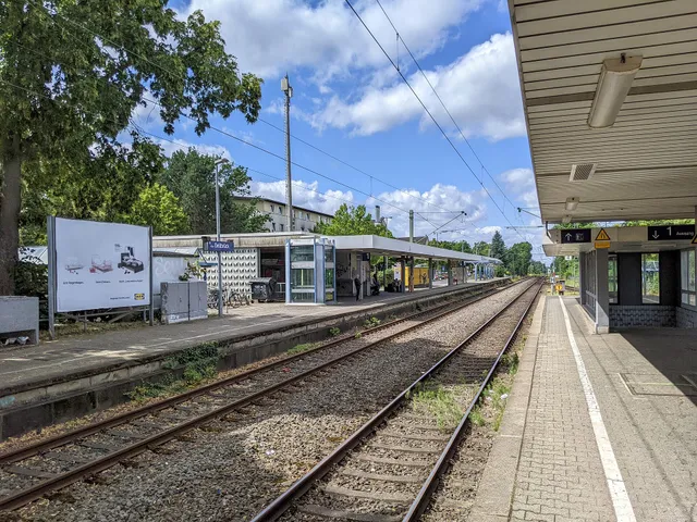
The northern part of the AirportBusinesspark spreads out around the station, and serving it is the stop's main purpose. Kölner Verkehrsbetriebe lines 151 and 152 call at two bus stops on the street; to tell it apart, the stop is named "Frankfurter Straße S-Bahn". These buses also let residents of Gremberghoven and the neighbouring district of Ostheim use the station. They run much of their route along Frankfurter Straße, calling at the light rail stops Buchheim Frankfurter Straße and Sportpark Höhenberg. They also serve the Ostheim light rail stop, about 2 km from the station.
Plans
With its many crossing lines, Frankfurter Straße resembles the Gürtel line on the left bank of the Rhine. Plans therefore call for extending light rail line 13 along Frankfurter Straße from Mülheim to Ostheim and on to the station. As part of the Cologne S-Bahn expansion, line S13 to Bonn-Oberkassel is also planned to run via the airport loop and thus through this station. Under these plans, the RB 25 is to become the S15, so the station would be served exclusively by S-Bahn trains.
Timeline
- 2003Köln Steinstraße halt opened on the Sieg line
- 12. Juni 2004Station opened with the Cologne airport loop
- 2004Gremberghoven station closed; Köln Airport-Businesspark halt added
Map
Blue dots: other places nearby — tap to explore.
You might also like — related or nearby
Comments
- Loading comments…
Sources & links
- Official website
- Official website (retrieved 2026-10-28)
- Wikidata (retrieved 2026-10-28)
- Wikipedia (retrieved 2026-10-28, rev 261382817)
Auto-generated, last verified: 2026-10-28
How this page is made
This page draws on open sources — Wikipedia, Wikidata, official websites and the city’s open data. Every statement is checked against the sources linked here, and pages are refreshed regularly.
Spotted a mistake anyway? Tell us below — we read every submission.