Poller Köpfe
Historic riverbank fortification on the right bank of the Rhine — built over 250 years to keep the river from carving a new course around Cologne.
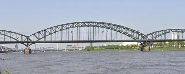
The Poller Köpfe are a historic riverbank fortification system on the right bank of the Rhine, directly opposite Cologne. They were built to prevent the Rhine from cutting a new channel east of Deutz, which would have severed the city and its harbour from the river.
Source: Wikipedia
At a Glance
- Type
- Historic Rhine riverbank fortification
- Location
- Right bank of the Rhine, district of Poll (Porz borough)
- Construction
- Major project begun in 1560, continued for over 250 years
- Scope
- Three heavy embankments, known as "Köpfe" (heads)
- Dimensions
- Northern head reportedly 1,500 metres long, rising up to 3.5 metres above water level
- Heritage status
- Listed monument; Poller Wiesen meadows under archaeological protection since 2005
To prevent the Rhine from cutting Cologne off from the river, the city began in 1560 deliberately sinking hundreds of ships, filling them with gravel and weighing them down with iron-reinforced oak trunks and basalt boulders — a construction project that continued for over 250 years. Two of these sunken vessels were only rediscovered in 2003 during dredging work, and turned out to be 12-to-15-metre 'Niederländer' ships built in 1530 and 1590 respectively.
Background and Threat
From the High Middle Ages onwards, Cologne's citizens observed that the Rhine — after repeated breakthroughs between Poll and Mülheim — might seek a new course eastward. Floods and ice drifts accelerated these shifts. A permanent eastern breakthrough would have cut Cologne off from the river and left its harbour stranded.
Construction and Conflict
In the early 15th century, a treaty with Archbishop Friedrich III of Saarwerden allowed Cologne to regulate the river's course using the Rhine islands of Poller Werth and Osterwerth. The treaty was revoked in 1479 and the Duke of Berg destroyed the existing works. Only in 1557 did the city council and Archbishop Anton von Schaumburg agree on a long-term lease of the Poll riverbank, and the ambitious project got underway in 1560.
Engineering and Upkeep
Hundreds of ships were scuttled and filled with gravel; willows and groynes were planted along the bank. Iron-reinforced oak trunks weighted with basalt were driven into the riverbed and joined by heavy crossbeams. In 1641 a stone weir replaced the timber piles. The severe flood of February 1784 nearly wiped out the willow planting on the Poller Wiesen, laying bare the relentless struggle to hold the river in check.
A Jewel for the City
In 1582, Cologne councillor Hermann von Weinsberg noted in his diaries that the head of Poller Werth extended a good distance toward Osterwerth with thick oak timbers, though not yet fully clad in planking. Much work had been done, he wrote, and a "precious jewel for the city of Cologne" was taking shape — one that would keep the Rhine in its bed.
Today and Archaeological Finds
With the construction of Deutz Harbour, the historic works were replaced by modern embankments and groynes. In 2003, dredging at the southern end uncovered two of the scuttled vessels — so-called "Dutchmen" measuring 12 to 15 metres in length, built around 1530 and 1590 respectively — and they were partially recorded by archaeologists.
Timeline
- Anfang 15. Jh.Treaty with Archbishop Friedrich III. permits Cologne to regulate the river course
- 1479Treaty annulled; fortifications destroyed by the Duke of Berg
- 1557New lease agreement with Archbishop Anton von Schaumburg; new fortifications agreed upon
- 1560Start of major construction project, continued for over 250 years
- 1641Stone weir replaces the wooden piles
- 1784Severe flood almost completely destroys the willow plantings of the Poller Wiesen
- 2003Two historic ships (built 1530 and 1590 respectively) discovered during dredging work
- 2005Poller Wiesen placed under archaeological monument protection as a historic riverside landscape
Map
Blue dots: other places nearby — tap to explore.
You might also like
Comments
- Loading comments…
Sources & links
Auto-generated, last verified: 2026-06-27